April 22
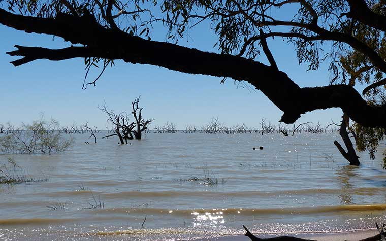
The drive to Menindee Lakes was about 110 kms but as we had heard the lakes were full and pretty spectacular, we had decided it would be worth the journey.
Lake Pamamaroo was the first lake we explored – it was full, and the area around looked very fertile with gums and a variety of native plants flourishing. There were quite a few free camp spots along the lake which looked great places to stay…as it turned out Gordon and Kerry had stayed there and had left that morning – we missed them by about half an hour.
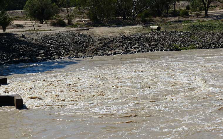
We drove up to the outlet regulator area which controlled the outflow of the lake into the Darling River – there was a large amount of water flowing and the birdlife in the area were really enjoying it – there were birds in the water catching fish in the turbulent outflow.
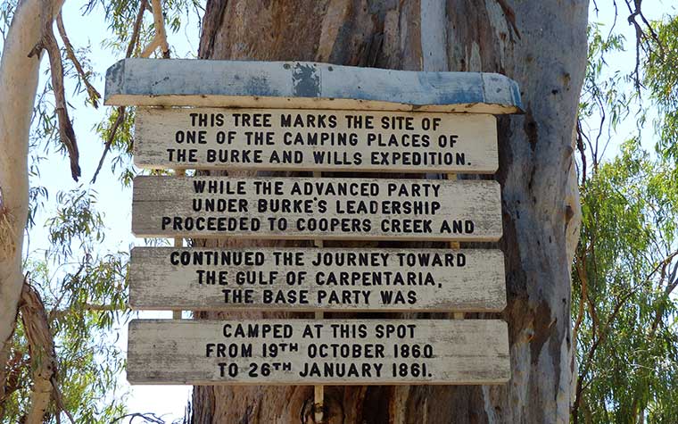
The place where the Burke and Wills expedition had their base camp from 1860 til 1861 was nearby so we stopped and had a look around the area. Unfortunately, Burke and Wills headed out on an exploratory expedition from there to the interior in October 1860 and never returned, perishing in the interior.
We continued our drive into Kinchega National Park and stopped for lunch at a picnic spot just near Menindee Lake along a creek. No one was in sight for our entire drive into the park but as soon as we sat down for lunch several cars drove in looking for spots to stop – seems we were the fortunate ones to have found the only picnic table around!! We enjoyed lunch…or most of us did. Trev was unsure about the salad but cheered up when the Twisties made an appearance.
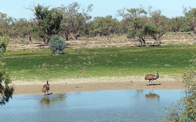
The road through the national park was great even though it was unsealed. We drove on and came to Emu Lake – aptly named with a couple of emus wading in the water.
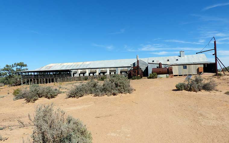
The large Kinchega Station that was once a lucrative sheep station was our next stop. The farming began here in 1870 and was once over 800,000 hectares in size extending from Menindee to Broken Hill. In 1967 the Kinchega section was given over to the National Parks.
We had a look over the old woolshed and shearers quarters… and Rosie got talking to some young shearers who were on holiday – looking at shearing sheds!!
Leaving the national park, we drove into the small township of Menindee and grabbed a great coffee and amazingly a scorched peanut bar at the local store!!!
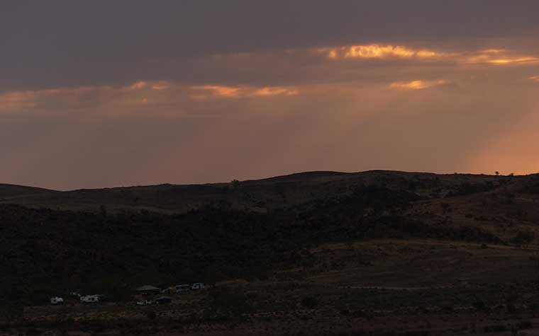
The drive home that afternoon really highlighted the arid landscape around Broken Hill as we left the lake area. Last night in Broken Hill – off to Milparinka tomorrow.
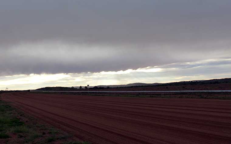
We awoke to a grey Easter Sunday for the pack up and move to our next destination, Milparinka. The race track at Broken Hill looked colourful against the grey skies.
As it was Sunday, we found a church in Broken Hill to go to before leaving town.
The Silver City Highway to Milparinka was long and straight and passed over arid areas of red dirt, stony desert areas, saltbush, and scrubby bush. Dry creek beds were evident, although a small amount of rain had fallen overnight which was evident in an occasional roadside puddle.
Some small lakes had water in them and there were hills and mountains in the distance at some points and endless flat desert areas at others. The skies were now blue with only wisps of white cloud and the temperature had risen.
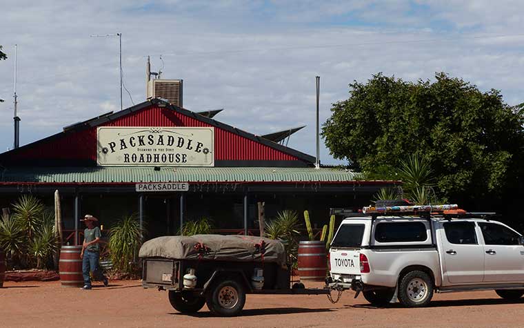
We stopped at Packsaddle Roadhouse for lunch. The local gymkhana was on that day, and it was pretty busy. The roadhouse was uniquely decorated with many hats, saddles and riding equipment. Outside were many vehicles parked with their destination obviously the gymkhana or a local station.
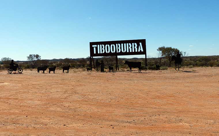
Milparinka is a small gold mining town that started after gold was discovered in the area in 1880. The Albert Goldfields were the first arid area goldfields in Australia and covered the area of Mt Brown, Milparinka and Tibooburra.
We set up camp in the caravan area behind the old courthouse and then went to look at the museums, historical displays and walk around the ‘town’.
Gold mining in the area continued despite the harsh drought conditions until 1904 when severe drought made the conditions untenable. In 2020 mining companies did some exploration around Mt Brown and some small yields are coming from there. Fossicking is popular in Tibooburra with gold still being found in the area.
Sheep farming and wool production is a big industry across a wide area of northwestern NSW. One of the most famous pastoralist family, the Kidmans, had donated early footage of the farming in the area which we watched.
A barn housed a lot of early mining and farming equipment exhibits. It must have been a very difficult and challenging era to live in working such heavy machinery in a very unforgiving and harsh climate.
In the old courthouse was a room dedicated to outback women – full of many records of courage, resilience, and heartbreak. Many died at a young age, lost children, babies, and husbands to the harsh conditions of outback life.
The Sturt exhibit was interesting – Sturt and his exploration party had been camped close by for 6 months at Depot Glen during a drought. The cairn they built as well as James Poole’s grave were still there and so we planned to take a quick trip out there tomorrow morning to take a look.
Next morning, we left the vans parked at Milparinka to do the short drive out to Depot Glen to have a look at Poole’s Grave and Sturt’s Cairn. Beryl stayed behind with the vans taking it easy.
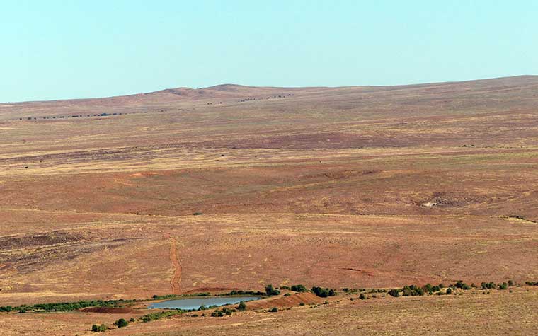
The drive was over pastoral land through a couple of cattle gates and I did a great job as gate wench. We found Depot Glen quite easily and Poole’s grave. You could see why the party camped for so long there in drought as it was very shady with a creek running through the area.
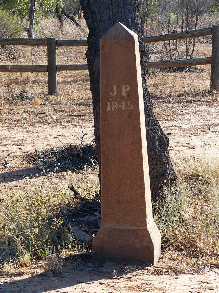
James Poole, assistant to Charles Sturt, had contracted scurvy on the expedition and was unwell for quite a while until he finally succumbed in 1845. Sturt buried him under the Grevillea tree which was still standing today – with the carving still evident in the trunk marking the grave. A tombstone was erected much later. A couple of other early pastoralists were also buried here.
We then drove on to Mt Poole where the cairn was that Sturt had his men build to keep them occupied while they were camped there waiting out the drought.
The area was very stony and arid – we climbed up the mountain to the peak where the cairn was… it was a longer climb up than we realised – steep at times and very rocky so we all had to watch our footholds carefully – no one wanted a faceplant on stony rocks.
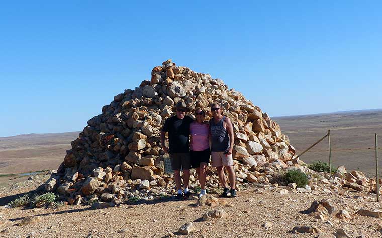
The views of the surrounding area were spectacular – it really gave you the perspective of the remoteness and you could see the creeks winding though the desert area marked by vegetation growing along them.
After descending very carefully, we drove back to Milparinka to pick up Beryl and the vans and continued along the Silver City Highway heading for Tibooburra.
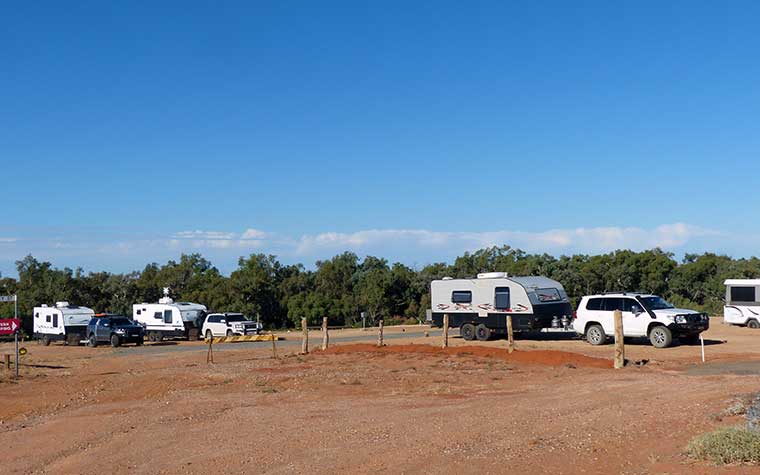
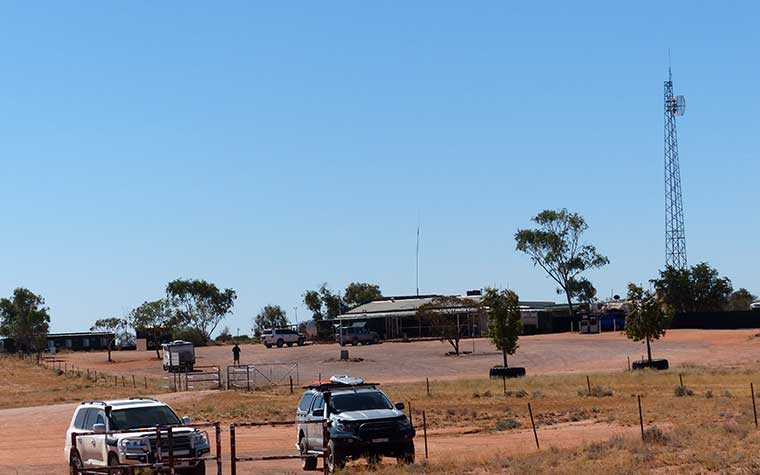
We arrived at Tibooburra and drove through to Sturt National Park and the Dead Horse Gully campground where we were camping for the next 3 nights. The name originated when 2 dead horses were found by miners in the gully – cause of death was unsure but the thought was that they had eaten something poisonous.
The campground was great with flat areas to park the vans together, some trees for shade and a picnic table near our site that Beryl got to and cleaned and swept. Was she taking over Rosie’s cleaning mantle?
After setting up camp and having lunch, we went back to town for a quick look and to get some fuel ready for tomorrow’s journey to Cameron’s Corner.
A quick drive around the town looking at the local buildings – the small hospital (the most remote in NSW), pubs, school, and even an old drive in theatre.
We had a look at the Pioneer Park which had displays and relics from Tibooburra’s past. A replica of the boat Sturt had taken on his expedition to find the great inland sea was on display.
The flies were pretty bad so the fly nets came out and before dinner once the heat had abated a bit (it was 35 C) we went for a walk around the Granites.
The plan for the day was to drive out to Cameron’s Corner where the 3 states NSW, South Australia and Queensland intersect. After getting advice on road conditions, we decided to take the longer Jump Up Loop and Middle Roads out and then come back along the Cameron’s Corner Road so we explored two different areas of Sturt NP.
Following the Jump Up Loop Road we drove through a lot of arid areas, and periodically along the road were ‘tanks’ built up with mud that had water in them. The tanks were a great spot to support local wildlife and vegetation – a variety of birdlife congregated around the tanks.
In the distance the Grey Mountain Range could be seen as we drove west, and the Jump-ups (flat topped mesas) came into view. Once at the top, we stopped at the Jump Up Lookout to take in the expansive vista over the plains and like everywhere we go, you don’t see another car on the road, but when you stop there are people there
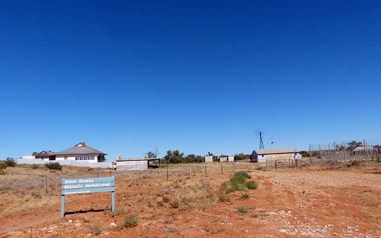
We passed the historic Olive Downs Homestead and all along the way was evidence of earlier pastoral activity.
There were a lot of dry creek crossings and the road varied from sandy to white limestone to red dirt in varying intervals. Nearing Fort Grey Campground we passed Pinaroo Lake which had milky water in it.
We turned on to Cameron Corner Road and then shortly after turned onto the Dunes Scenic Drive for the last leg to the corner. As we got closer to the corner the red dunes became more evident and the road was undulating with multiple crests which required caution on approach. All in all the road was amazingly good all the way out to the corner.
We crossed into the wildlife sanctuary that had been established to reintroduce native species that had become extinct in the area, like bilbys, burrowing bettongs, western quolls, stick nest rats and golden bandicoots.
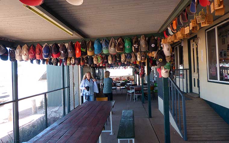
At the border there was a gate in the dog fence (longest fence in the world) which we opened and drove through into South Australia, turned right and drove immediately into QLD were Cameron’s Corner Store and Fuel stop was located. The Corner Store had a collection of caps from all over the place. Although we had packed lunch we opted to buy local to support the store and so sat in the dining area eating yet another healthy pie/chips etc etc.
After lunch we went over to the marker where the 3 states join and took some pics. Cameron’s Corner was named after John Cameron, a surveyor for NSW Lands Department who surveyed the state borders in the 1880’s. In September 1880 he placed a wooden boundary post in this area marking the state borders and engraved latitude 29 on it plus his name. The original post is still on display in the National Parks Museum at Tibooburra.
We left Cameron’s Corner and returned via the Dune Scenic Drive to Cameron’s Corner Road and drove that way back to Tibooburra. The landscape along the way was more arid than that on the way in.
After a long day of driving we arrived home at camp and cooked and ate in the vans as the flies were pretty bad. The night was hot and made for a restless sleep for some.
The morning looked a little overcast as we woke to another day in Tibooburra. The plan for the day was to do the Gorge Loop Drive east of Tibooburra. The Outdoor Pastoralist Museum was the first stop along the way and was a very interesting collection of exhibits of early farming equipment and machinery. Ingenious yet cumbersome methods of obtaining water and pumping it into troughs for the cattle were on display as well as other steam driven equipment. Again we were struck with just how hard it must have been for the early farmers on the land managing in the heat. Drought and lack of equipment plus the sheer size and weight of some of the steam driven machinery.
We drove on to the Mt Wood shearing shed. Mt Wood shearing shed was still in operation in the 1970’s but now is no longer used. It was again the same style of shearing shed that has been used for over 100 years. Swallows were now nesting in its roof area.
We walked out and over to the suspension bridge that crossed the creek to the shearers quarters. These are now used as accommodation by the NPWS – people can book and stay there in the original but refurbished quarters.
The cloud cover was increasing but we went out to Sunset Lookout over Tibooburra where there was a free telescope to look out over the area. We watched the sun go down bit it was not so spectacular due to increasing cloud. It began to rain when we got back to camp so we had dinner in the vans.